


Using Google Earth for Vacation Planning & Virtual Escapes
go.ncsu.edu/readext?1011506
en Español / em Português
El inglés es el idioma de control de esta página. En la medida en que haya algún conflicto entre la traducción al inglés y la traducción, el inglés prevalece.
Al hacer clic en el enlace de traducción se activa un servicio de traducción gratuito para convertir la página al español. Al igual que con cualquier traducción por Internet, la conversión no es sensible al contexto y puede que no traduzca el texto en su significado original. NC State Extension no garantiza la exactitud del texto traducido. Por favor, tenga en cuenta que algunas aplicaciones y/o servicios pueden no funcionar como se espera cuando se traducen.
Português
Inglês é o idioma de controle desta página. Na medida que haja algum conflito entre o texto original em Inglês e a tradução, o Inglês prevalece.
Ao clicar no link de tradução, um serviço gratuito de tradução será ativado para converter a página para o Português. Como em qualquer tradução pela internet, a conversão não é sensivel ao contexto e pode não ocorrer a tradução para o significado orginal. O serviço de Extensão da Carolina do Norte (NC State Extension) não garante a exatidão do texto traduzido. Por favor, observe que algumas funções ou serviços podem não funcionar como esperado após a tradução.
English
English is the controlling language of this page. To the extent there is any conflict between the English text and the translation, English controls.
Clicking on the translation link activates a free translation service to convert the page to Spanish. As with any Internet translation, the conversion is not context-sensitive and may not translate the text to its original meaning. NC State Extension does not guarantee the accuracy of the translated text. Please note that some applications and/or services may not function as expected when translated.
Collapse ▲It’s finally SUMMER. Summer is grilling, boating, or hiking. It’s time to relax and have fun. It also means time for most people to get away with family. Planning those vacation getaways can be stressful. Just ask my sister. We live in a time where the world is at our fingertips. The internet is a powerful tool and can be helpful in planning your summer getaways.
In a world where wanderlust often battles with time and budget constraints, Google Earth emerges as a powerful tool for both planning vacations and indulging in virtual escapes. This incredible platform not only allows users to plan their travels but also offers a means of exploration for those who may not be able to embark on a physical journey.
Planning Vacations with Google Earth
 When it comes to vacation planning, Google Earth provides an exceptional level of detail and immersion. It’s truly unbelievable the detail Google Earth offers. Travelers can:
- Scout Destinations: Virtually visit potential vacation spots to get a sense of the environment, landmarks, and local attractions. This can help in making informed decisions about where to go.
- Plan Routes: Map out routes for road trips, walking tours, or even cycling adventures. Seeing the journey laid out visually can help in estimating travel times and distances.
- Discover Hidden Gems: Google Earth’s extensive imagery and user-generated content often reveal lesser-known attractions and local favorites that might not appear in standard travel guides.
Virtual Escapes for Non-Travelers
 For those who can’t travel, Google Earth offers a rich virtual escape. Here’s how:
- Virtual Tours: Many famous landmarks, national parks, and cities offer virtual tours. Users can walk through the streets of Paris, hike the trails of the Grand Canyon, or explore the ruins of Machu Picchu from their living room.
- Cultural Exploration: Explore museums, historical sites, and cultural landmarks around the world. Google Earth includes detailed tours of places like the Louvre in Paris or the ancient city of Petra in Jordan.
- Educational Journeys: This platform can be a great educational tool, providing detailed information and visual context for learning about different parts of the world. It’s perfect for students or anyone looking to expand their knowledge.
- Natural Wonders: Experience the beauty of natural wonders such as the Great Barrier Reef, the Amazon Rainforest, or the Aurora Borealis. Google Earth’s high-resolution images and 3D views make these experiences vivid and memorable.
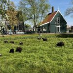
A Local Example
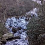 For an example of this tool, I created ‘A Look at McDowell from the Outside‘ using Google Earth. Click on the link, and see where Google Earth can take you right here in McDowell County.
A Tool for Dreamers and Planners Alike
Whether you are planning your next vacation or simply yearning for a mental escape, Google Earth caters to both. It bridges the gap between dreams and reality, offering a taste of the world’s wonders to anyone with an internet connection.
In an era where virtual experiences are becoming increasingly sophisticated, Google Earth stands out as a useful tool. It brings the far corners of the globe to our fingertips, making the world a smaller, more accessible place. So, the next time you feel the urge to explore, remember that a world of adventure awaits you on Google Earth.
Need help with technology, come to Tech Time with Molly on Tuesday, July 9, 3 p.m., McDowell County Library, Marion.